viz.
Visual Rhetoric - Visual Culture - Pedagogy
Site informationRecent Blog Posts
|
Report from the Classroom, Part 2
Submitted by Laura T. Smith on Mon, 2010-04-12 22:48
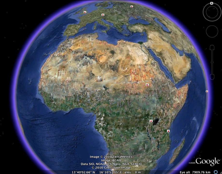
(Image credit: Google Earth map created by Smith's RHE 306) Caroline and I completed our Food Geographies Collaborative Writing Workshop last week. My students decided to keep their class map broad, not restricting it to Austin, to Texas, or to the United States. As a result, the geographies they trace are provocative, but also somewhat diffuse. That is, we might have gotten better results by densely mapping a limited area, but patterns emerge on our worldwide map that would not otherwise have been visible. While many students chose to map sites in the Austin area or the United States, the above map shows the efforts of two students who worked on mapping some non-U.S. sites, including major World Food Program sites, fast food locations in developing counties, and key sugar-producing sites. More detail on these sites and others, after the jump. I had some difficulty getting students to think about food controversies in terms of what information should go on a map. Many students wanted to map corporate headquarters of relevant companies such as Kraft, McDonalds, and Monsanto. While I think it’s actually quite helpful for students to see these companies as physical, located entities, I’m not sure that their geographical placement on the map tells us as much about food politics as, say, one students’ mapping of key sugar industry sites, or another student’s mapping of fast food restaurant locations in developing countries. I’m hoping that we’ll be able to make more of these connections about the geography of food during our closing discussion on Tuesday. I wonder if, in the future, it would be helpful to give the map a more focused theme, e.g., “How might we map hunger?” “Or how might we map nutrition?” Here are some highlights:
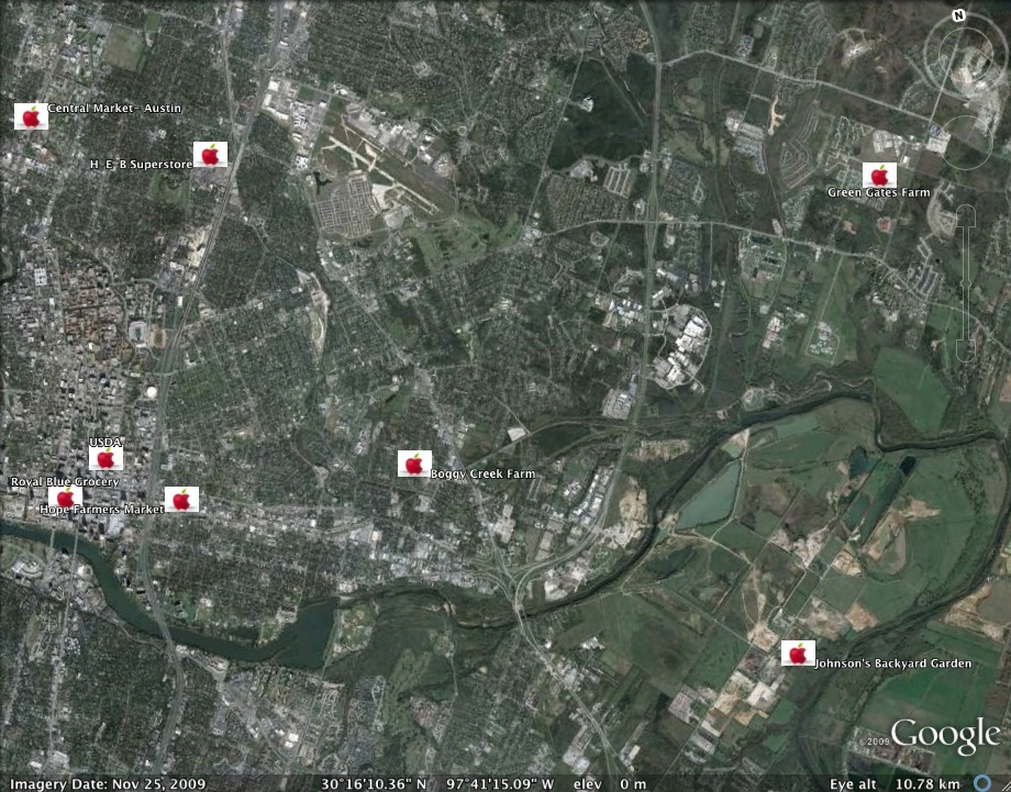
(Image credit: Google Earth map of farms and CSAs near Austin, TX, by students in Smith's RHE 306.) On Tuesday, we’ll finish the exercise by analyzing the map and having a conversation about what’s missing from our class map. In addition, we’ll overlay Caroline Wigginton’s class map and discuss the ways the expanded map enacts collaborative writing. We’ll also note differences in the two classes’ approach to food politics. In conclusion, I want to add that the students seemed to really enjoy this exercise. The were eager to jump onto computers on find places to plot, latitudes, longitudes, and images on Tuesday, and on Thursday, as they transferred their data from the Placemark Data Collection Worksheet to the class spreadsheet (which they all edited simultaneously from individual computers, using Google Documents), they were eager to see their results show up on the projection screen. The exercise was dynamic and collaborative and provided a refreshing change of focus and pace for the class. The students also seem to be interested in the prospect of composing their final “paper” as a Google Earth narrated tour, an option I’ve allowed them. I’m looking forward to receiving a number of these. |
|
Recent comments
2 years 29 weeks ago
2 years 44 weeks ago
2 years 44 weeks ago
2 years 50 weeks ago
3 years 4 weeks ago
3 years 4 weeks ago
3 years 4 weeks ago
3 years 6 weeks ago
3 years 6 weeks ago
3 years 6 weeks ago