viz.
Visual Rhetoric - Visual Culture - Pedagogy
Site informationRecent Blog Posts
|
Coming Close to Environmental Disaster
Submitted by Laura T. Smith on Wed, 2010-04-21 00:47
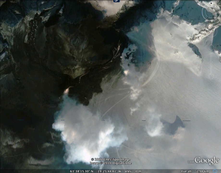
(Image Credit: Google Earth image of ash cloud in Iceland , produced with GeoEye satellite imagery) My very dear friend Tes is stuck in Ireland this week,
grounded by the great Iceland ash cloud and hoping to get back in time for her
dissertation defense. She’s been
looking for a t-shirt that says, “Eyjafjallajokull 2010” for days, but
evidently, no one’s selling. What I found was interesting. Upper Big Branch Mine in Montcoal, WV can be seen, in its current state, in this photo.
(Image Credit: Google Earth image Upper Big Branch Mine in Montcoal, WV) It’s a mountaintop mine, so what you see is a mountain with its top cut away. If you have your “Global Awareness” layer turned on (as I do in the above picture), you’ll see a yellow box drawn around the mining site. These boxes appear around mountaintop mining sites throughout West Virginia and are maintained by Appalachian Mountaintop Removal, a group that has built an electronic “Memorial For the Mountains.” You’ll see a blue square at the upper-left corner of the yellow box. If you’re in Google Earth and you click on that square, you find historical imagery of the mining area. The below image shows the same mountain in 1986.
(Image Credit: Google Earth historical image Upper Big Branch Mine in Montcoal, WV) The difference is startling, and the Appalachian Mountaintop
Removal project's electronic memorial makes this information readily and publically available. Each "Memorial" placemark links to the previous and next mountain on
the tour, so you can click through them and learn about the history
of West Virginia’s natural areas and the mining industry's activity. The
organization says that they will continue to archive imagery, with the goal of
providing three decades of continuous historical imagery to document the
area’s rapid change. Tags:
|
|


Recent comments
2 years 29 weeks ago
2 years 44 weeks ago
2 years 44 weeks ago
2 years 50 weeks ago
3 years 4 weeks ago
3 years 4 weeks ago
3 years 4 weeks ago
3 years 6 weeks ago
3 years 6 weeks ago
3 years 6 weeks ago