viz.
Visual Rhetoric - Visual Culture - Pedagogy
Site informationRecent Blog Posts
|
spatial theoryThe Secret History of Lines
Submitted by Laura Thain on Mon, 2012-11-05 13:53
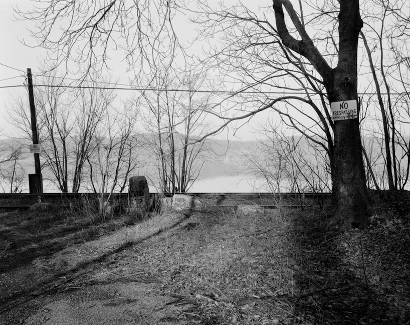
Image Credit: Colin Stearns With 24 hours to go, media outlets projecting the outcome of election day are covered in geographical maps of states and counties painted starkly in red and blue. I’ve enjoyed the responses of armchair intellectuals like Randall Munroe, who playfully reinterprets the red/blue divide to create a complex and comprehensive visual history of the Republican and Democratic parties. The proliferation of regional and ideological divides across multiple media this week urged me to explore two important questions in visual rhetoric: What does it mean to visualize a geographical boundary? And what does it mean to visualize an invisible line? (I would be remiss not to mention the enormous amount of border studies that exist in postcolonial and Anglophone literature and criticism—but today on viz I will try to confine myself to a discussion of the visualization of intranational borders.) Here to help me is the photography of Colin Stearns, Assistant Professor of Photography at Parsons. Stearns' current project is photographing the Mason-Dixon line in order to capture "this border of cultural distinction at the places of its occurence." Each of his photographs contain the invisible interstate line somewhere within their composition. I'll also put Stearns in dialogue with William Byrd II, the 18th century commissioner of the colonial line between North Carolina and Virginia.
|
|
Recent comments
2 years 29 weeks ago
2 years 44 weeks ago
2 years 44 weeks ago
2 years 50 weeks ago
3 years 4 weeks ago
3 years 4 weeks ago
3 years 4 weeks ago
3 years 6 weeks ago
3 years 6 weeks ago
3 years 6 weeks ago