viz.
Visual Rhetoric - Visual Culture - Pedagogy
Site informationRecent Blog Posts
|
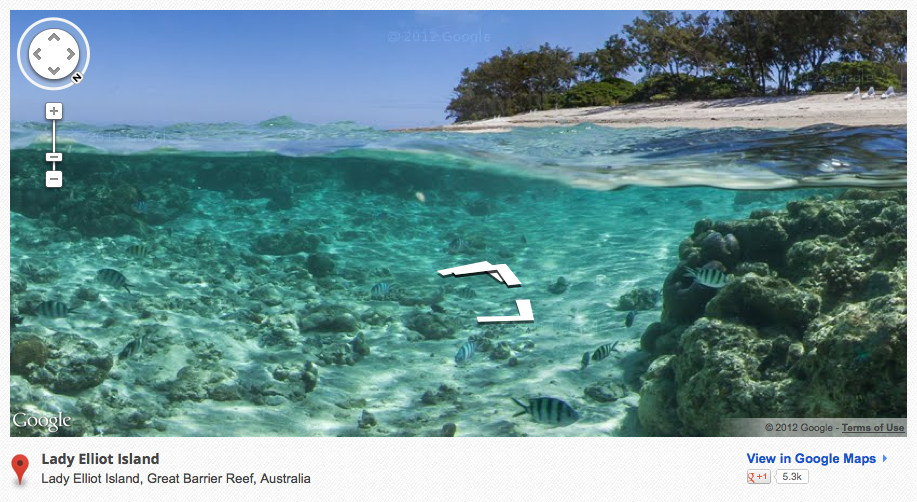
Street ViewGoogle's "Sea View" and Marine Metaphors for the Web
Submitted by Calliope on Thu, 2012-09-27 15:31
Image Credit: Google Streetview Gallery Google Maps has a remarkable new feature called Sea View that spotlights oceanic life and space. Sea View is essentially the marine version of Street View, a layer of Google Maps that allows users to navigate though 360-degree panoramic images of the Earth's surface. By extending the concept of Street View to the ocean floor, Google has added six coral reefs to the long list of cities, landmarks and parks users can currently explore remotely, from the comfort of their digital devices. The fascinating images captured so far by Google and its partner, Catlin Seaview Survey, bear out the imaginative quality of the overarching project. It's almost as if Sea View is Google's attempt to fulfill a common childhood fantasy: to experience what it would be like to live under the sea. With its zoomable and virtually traversable underwater imagery, Sea View enables adults and children alike to realize this wish (without having to worry about oxygen supply or the expense of travelling to distant coral reefs). Oddities Caught in Street View
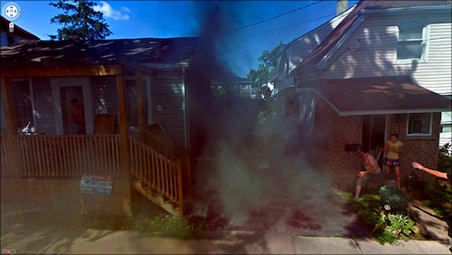
Submitted by Jay Voss on Wed, 2012-02-22 10:00
Image Credit: Google I had ten minutes to kill yesterday afternoon, and I spent them clicking around on The Guardian’s website. And while I was thinking about posting on something else today, this weird collection of images came across my screen and I thought it’d be fun to put them up. They’re a collection of images amassed by Jon Rafman of people and animals doing funny and/or stupid things when the Google Maps Street View van drove by. Some of them are really quite entertaining, and I encourage you to take a look if you haven’t seen them already. Most of the images have correct corresponding addresses and can be found in Google Earth Street View, which confirms for the weary that these things actually happened. Some of the addresses are ambiguous (e.g., “Victoria Highway, Gregory, Australia”) and it’s hard to find their corresponding images on Google Maps, which is a shame. Sometimes you wish you could move up and down a given location and discern how a given scene developed. In addition to the selections that can be found on The Guardian’s website, even more can be found on Rafman’s website here.
Tags:
|
|
Recent comments
2 years 29 weeks ago
2 years 44 weeks ago
2 years 44 weeks ago
2 years 50 weeks ago
3 years 4 weeks ago
3 years 4 weeks ago
3 years 4 weeks ago
3 years 6 weeks ago
3 years 6 weeks ago
3 years 6 weeks ago