viz.
Visual Rhetoric - Visual Culture - Pedagogy
Site informationRecent Blog Posts
|
What would Proust do with Google Maps?
Submitted by Jake Ptacek on Tue, 2011-11-15 09:00
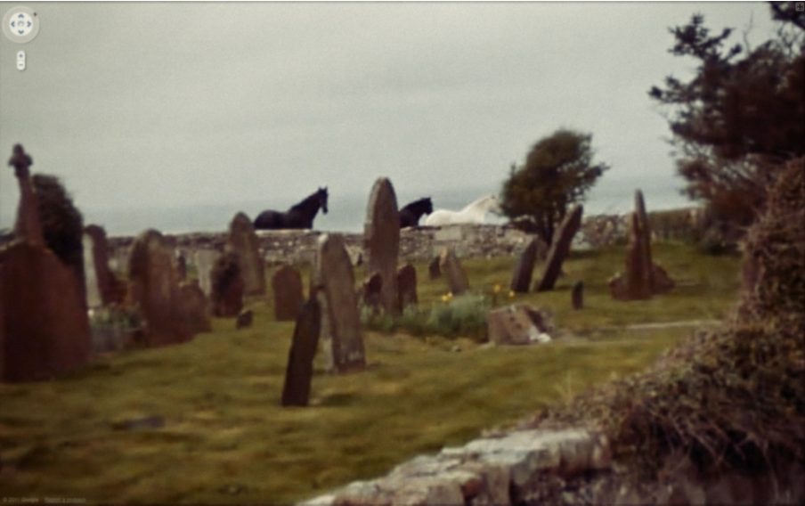
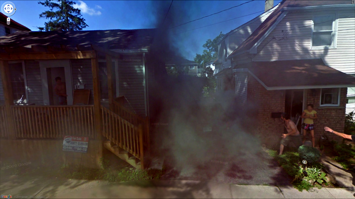
Screenshot from Google Maps via Jon Rafman In David Sasake's blog post, "How to read Google Earth like Proust," he notes that Marcel Proust liked to read train timetables before bed. According to Alain de Botton, "[T]he mere names of provincial train stations provided Proust's imagination with enough material to elaborate entire worlds, to picture domestic dramas in rural villages, shenanigans in local government, and life out in the fields." Place names can float up in our subconsciousness, rekindling memories long forgotten like rabbits pulled out of a magician's hat. So what would Proust make of Google Maps, and especially Google's massive, ongoing "Street View" function, where an ever-expanding swath of the globe is mapped, photographed, and instantly accessible? What happens when you can view almost anyplace, anytime?
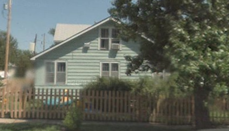
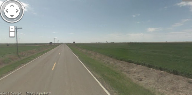
Screenshot from Google Maps I'm asking because I spent the afternoon visiting places from my past, not in reality, but through Google Maps. That house above, appropriately blurry, is the house I lived in as a small child. Though hazy, as with memory, I can visit it anytime online; though I'm now some eight hundred miles and twenty years away from it. I can retake my morning walk to serve 6 am mass at the Catholic church, if I want. Or, as below, I can recreate the drives into the country that I--and every other underage smoker with a car--took on summer days a decade ago.
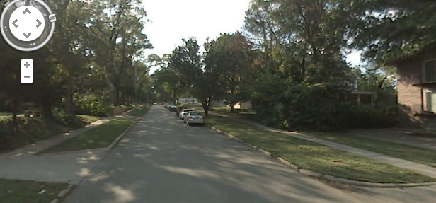
Screenshot from Google Maps Or I can, if I want, stand at the very street corner where I said goodbye for the last time to my first college girlfriend (on a day when the shadows of the trees stretched out across the street in just the same way as below). But Google Street view is fickle: though I can wave goodbye forever, I can't (yet) stand at the streetcorner where I first met my wife.
Screenshot from Google Maps
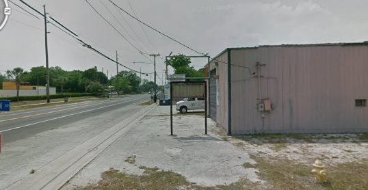
Screenshot from Google Maps And though I can stare down the street above forever--where, while being mugged at gunpoint, once upon a time I thought that empty billboard might be the last thing I would ever see--I can't at the moment recreate the view from my Catholic school's parking lot, or see the park my teenage friends and I would sneak out to after curfew. The street view function of Google Maps seems tailor made for such Proustian reveries. Like memories, it's full of gaps. Places that you ought to be able to find aren't there. Places you never thought you'd see again are suddenly at your fingertips. What fascinates me is the power to recreate: to walk down streets you'd long forgotten and to recognize the incongruous, some detail that brings the past flooding back to you. Like so much on the internet today, there are whole communities dedicated to this kind of recovery of the past, though my favorite is Ogle Earth. I found it through Sasaki's aforementioned blog, and it's well worth checking out. Using Google Maps, Stefan Geens has mapped out one of the Hippie Trail routes through Afghanistan--a virtual recreation of a (now seemingly-impossible) past. Similarly, the website What Was There overlays historical information--particularly photography-- onto current Google Maps, allowing the user to "see" the past.
Screenshot from Google Maps via Jon Rafman Though not yet a part of history, Jon Rafman's sometimes haunting (see the photograph at the top of this piece), sometimes comic, sometimes somewhere-between-the-two (see the photograph above) cullings from Google Street View seem a fitting place to end this post. Rafman's work, the best of which is featured here along with an excellent essay here, collapses the distinctions between the utilitarian and social value of Google's project and the "street photography" movement that flourished in Cartier-Bresson's wake. Rafman's images seem pulled from a collective (Proustian?) unconscious that also happens to be the obhjective world around us. He winnows out of the omnidirectional impassive cameras attached to Google's vehicles images that provoke social consciousness, laughter, even an occasional mystical awe at the world around us. Strangely enough, the seemingly quixotic, because practical, goal of Google Maps--the ability to plan routes in any part of the globe--has become a repository for half-a-decade's worth of what Cartier-Bresson would refer to as "decisive moments." |
|
Recent comments
2 years 29 weeks ago
2 years 44 weeks ago
2 years 44 weeks ago
2 years 50 weeks ago
3 years 4 weeks ago
3 years 4 weeks ago
3 years 4 weeks ago
3 years 6 weeks ago
3 years 6 weeks ago
3 years 6 weeks ago